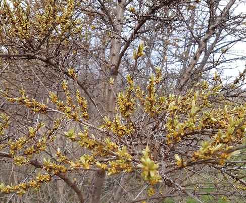
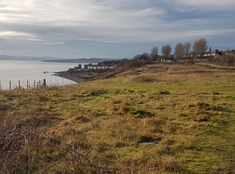
In the weak, blinking sunshine, wind-chilled and watery, The top fields swarm with detectorists from West Lothian, Thinly spread, rigorously spaced, slowly they move, like cautious extra-terrestrials, each has a rigid, but fluidly-swaying trunk, held just above the ground, all wear rucksacks or cloth bags that sport spade-shaped antennae.
Every so often, a detectorist drops to his knees and starts to dig, carefully refilling each hole before moving on. I greet a smiling pair of them at the gate. “I only get Sunday off, but I wouldn’t be anywhere else,” says one. Do they find treasure? Laughter rings – “be better off buying a lottery ticket for that!” But…. each has a tale to tell, of tobacco tins and Victorian pennies; last weekend, a Bronze Age spearhead – “in this very field!” And anyway, “it’s this I enjoy best,” – throwing an arm towards the hills, the grazing geese, the spruced-up-for-spring yellowhammers in the hedge – “being outside. The scenery. And the people are all lovely.”
They are. I admire their hi-tech gear, wish them luck…. And off they go again. Watching their measured tread, I know (whether they do or not) detecting’s a walking meditation, just as anglers sit and meditate on water, fish or no fish.
With implacably good timing, I finished my coffee to arrive at the Holiday Inn on the edge of Perth, seven minutes before the hourly bus home. Bang on time, I saw a bus crawling up Dunkeld Road. I slid to the edge of the pavement. But wait – was it a bus? No Stagecoach livery, a plain white coach, beetling along rather fast. I screwed up my eyes: nothing on the front to say what number – or any number – or destination. The tinted windows didn’t allow me to see if it carried passengers. A private coach, then? I sighed and stepped back.
As it hurtled past, driver not even glancing at the bus stop, I saw, on the side, “23 – Bankfoot”. The air turned blue outside the Holiday Inn, as I gawped in disbelief and watched it sail off without me. What to do? No, I wasn’t going to go for another coffee. I certainly wasn’t going to sit staring at a petrol garage while inhaling the noxious air of Perth’s god-awful motor mile for an hour. One does not get a “pleasant stroll” down Dunkeld Road, but eventually I began to walk towards town, undecidedly, seeking equanimity.
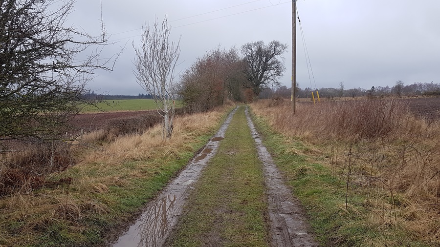
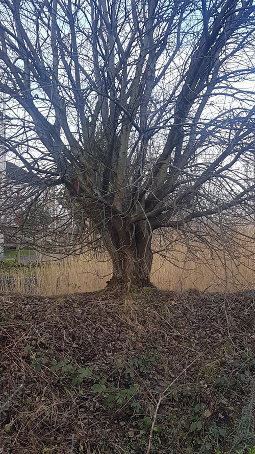
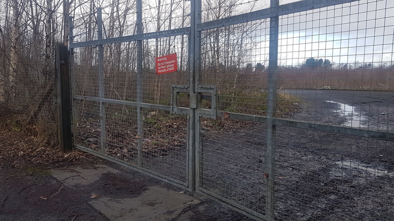
A couple of minutes later, just before the rail bridge, I noticed a tucked-away footpath sign: Lade Walk to Perth/Tulloch. Perth Lade is an historic man-made waterway which fed into the town’s mills. I knew the Tulloch bit, and the bit from the retail park to the City Mills, but this stretch – I never knew it existed. The Lade is grotesquely polluted for much of its length these days, but I know people who have spotted kingfishers hunting there, and the incredibly tolerant mallards of Perth make the best of it, and eat discarded chips. I ducked along a narrow path between the railway and the fenced car park of some tedious car dealer, with little optimism. Surely all I had in store were industrial lots and housing estates? The narrow path broadened as it reached the Lade, curving round from the west, and I heard flowing water and the busy furking-about of moorhens in the thick undergrowth on either side. The irritating groan of the Dunkeld Road traffic had completely disappeared, yet surely I must be not far from, and parallel to, it? To my left, a thick bank of mature trees, mostly self-sown and densely overgrown, had shed small branches and twigs in profusion during the winter storms. Accumulations of litter, initially like glue in the conglomerate of nature’s own debris, were slightly fewer than at the start, though one spot behind the ugly chainlink fence was a veritable carpet of empty beer bottles – either decades’ worth of boozing or the emptying of an accumulation someone didn’t want on their own doorstep.
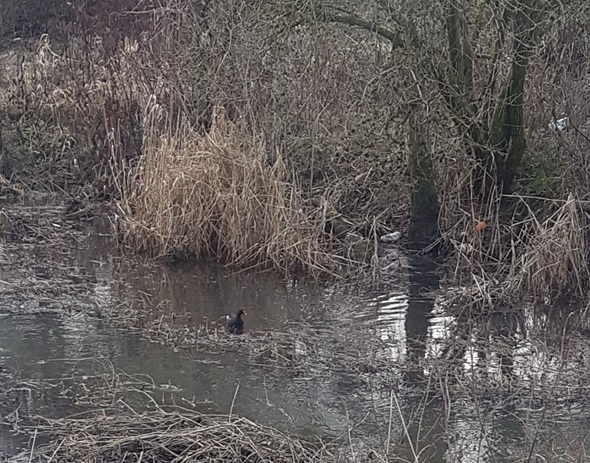
Five sleeping mallards sat camouflaged on the far bank, not moving, until I got my phone out to take their photo, when they all silently uncurled sleepy heads and glided off downstream. Moorhens, in vibrant plumage ready for spring, hung about, quite tame, crossing the path and ferreting in the reeds on their spindly legs. The larger trees thinned to a narrow belt and behind the fence was a huge expanse of derelict industrial land, half-concreted or tarmac in places, but being rapidly colonised by pioneer birch. elder and other young trees. In January, all looked grey, but from the lying vegetation of last summer I could guess at the wealth of wildness that would spring up, laughing at human arrogance, when the season turned again. Bare young trees may look like a delicate screen, but never doubt their power and ability to exploit a vacuum. Nor that of the dandelions, dockens and bombsite weed, all bringing seeds and nectar to wildlife. On cue, a terrible high-pitched squeaking started up in one of the older sycamores – a flock of long-tailed tits on the rampage. I stopped and birdwatched for a while – coal tits and blue tits were weaving between the branches and a cheeping of chaffinches held forth from some bushes by the lade. On the path, first a male bullfinch, then his duller mate, landed and had a good look around before returning to the other side of the lade. Blackbirds and a thrush hopped out and eyed me beadily.
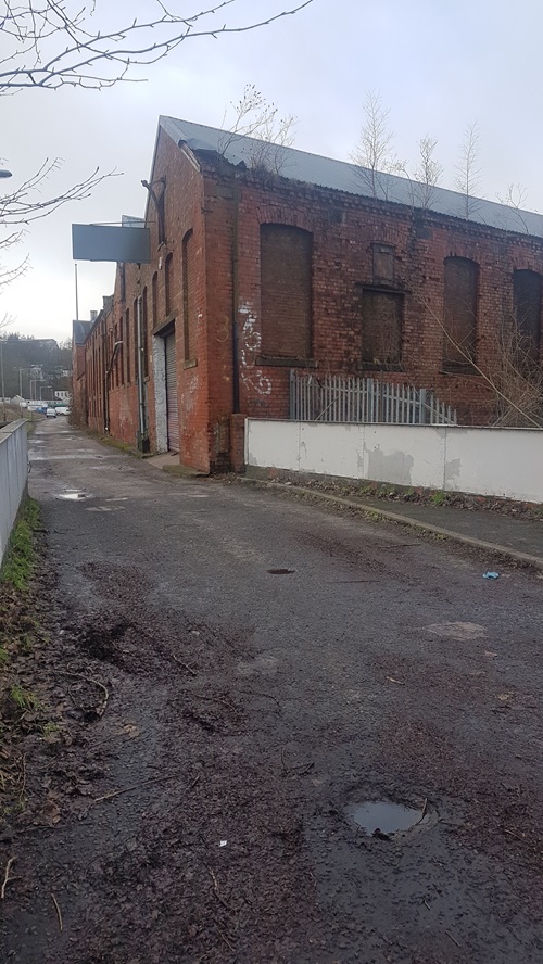
I came to a junction – a path crossed the Lade by bridge, past an old brick building – possibly a former mill but now another garage. It was attractive though, and full of potential nesting sites. Here, there was a sign on the fence – all this derelict land, stretching into infinite distance with no trace of the motor mile, belonged to the railway, which was nowhere to be seen but must be in there somewhere. I hoped it would stay their property, and they would never try to tidy it up or sell it to developers.
There were houses and flats now on the other side of the Lade, so near, yet curiously far and separated from this unexpectedly lovely and interesting walk. A large willow on the far bank was decorated with ribbons, toys and ornaments, like a wishing tree of old. I wondered who came out of their homes to celebrate or remember there. The ground on my left opened out, seeming endlessly wide. Lade and path swung eastwards and I saw an iron bridge, unmistakably a railway footbridge, just like the one I used to play under as a child in east London.
And over the bridge, where teenaged girls stood discussing the wicked-looking, monstrous-headed dog they thankfully had on a tight lead, Dunkeld Road reappeared. I swerved away from it, passed through some houses and across Crieff Road, where I joined the Lade stretch I knew well, skirting old tenements and road ends, bits of gardens and the ubiquitous smell of cannabis. Passing Stagecoach Headquarters, I surreptitiously made a rude sign. No time to march in and complain, if I wasn’t to miss the next bus as well! But thanks to their rubbish driver, I had discovered a stretch of unofficial countryside that I’ll revisit in summer, I’d enjoyed an unexpected daunder, found equanimity – and, moreover, escaped Dunkeld Road.
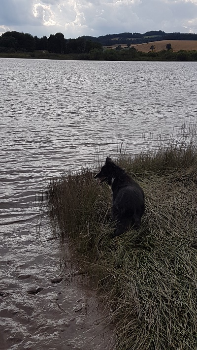
(It’s taken me a while to write this walk. I did it the day the clocks went forward, end of March, and today they went back again. My 14 year old collie died in early summer, and this was the first walk I decided it would be unfair to take him on, so it was a bit poignant; and weird not to have him beside me all the way.)
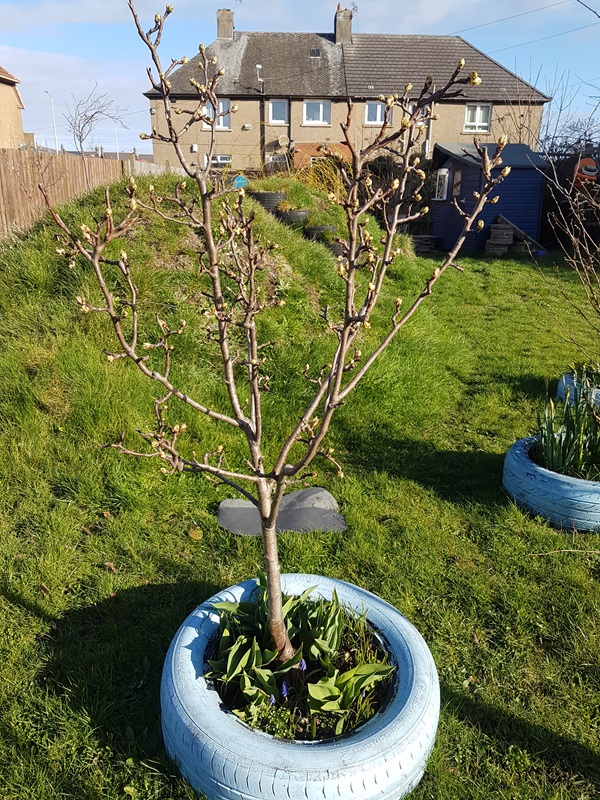
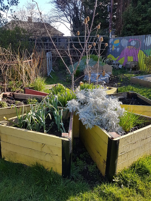
It began at the CLEAR Community Garden in Methil where I left Andrew to deliver a workshop. CLEAR stands for Community-Led Environmental Action for Regeneration, and is a very active charity whose stamp is all over the former mining towns of Methil and Buckhaven in Fife. We’ve worked with them a lot over the years – their compulsion to fill every available space whether roadside or cliff-top with fruit trees was one of the inspirations that got us into orchards in the first place. The Methil garden was pretty stunning; I had a good look round to admire the recycled materials, the superb compost bays (I do love a good compost heap) and pear trees about to blossom, before heading off into the cold, breezy sunshine.
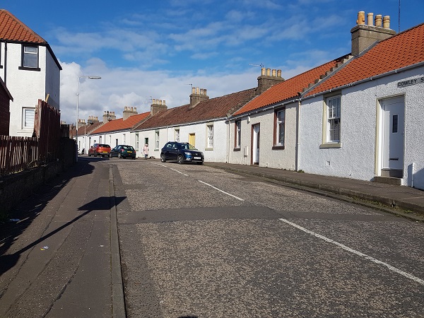
Zig-zagging through Methil, side-stepping CLEAR plantings on the edges of parks and in vacant plots, till the town had morphed into Buckhaven, or Buckhyne if you like, the place of superlative pies and hidden histories, from the extravagant exposure of Fife coast geology, the sturdy cottages of Cowley Street and relics of the long-disused mine railway – all explained in panels erected by CLEAR and Fife Council.
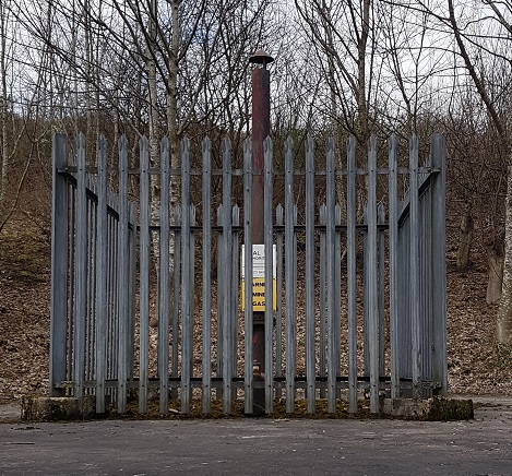
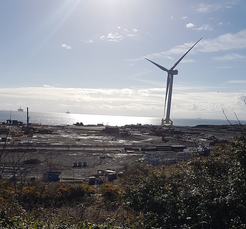
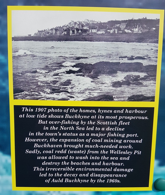
I’ve become rather fond of urban walking lately, for the unexpected quirks of history, and opportunities to see the extraordinary hiding behind the mundane. Here, I learned of the “lost village” of Buckhaven Links, which grew, mushroom-like, on the shore when the Church of Scotland had one of its fallings-out and mislaid a large part of its congregation. Buckhaven Links did not survive too long, and is now buried under the Buckhaven Energy Park, a darkly towering set of anonymous edifices over the wall from the street.
Buckhaven Energy Park
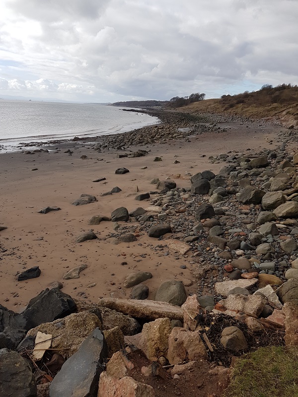
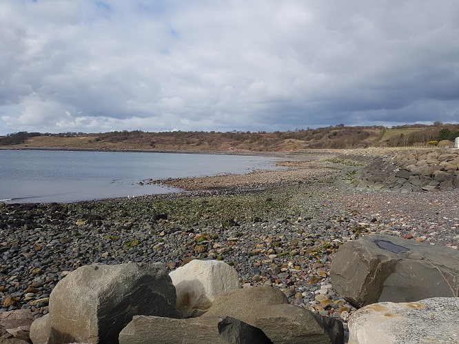
That road took me past rows of houses with signature Fife/East coast crow-stepped gables to where Buckhyne Harbour once was, until it was abandoned due to over-fishing and used as a repository for mining spoil. Beyond the harbour site, a scramble through rocks and there was the beach, for a while and pre-pollution a popular holiday and day trip destination for Fifers and those beyond the kingdom.
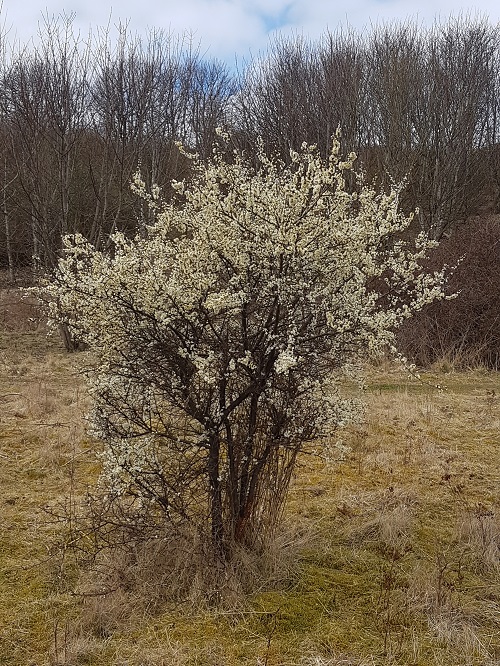
Up, then, climbing skyward the Buckhaven Braes, lit by the silver of blackthorn blossom and the gold of Sea Buckthorn, peppered with orchard trees, all labelled, all immaculately pruned and protected, the coast path lined with daffodils in flower, until this extraordinary little town was behind me and I marched along westwards towards East Wemyss.
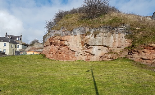
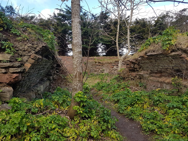
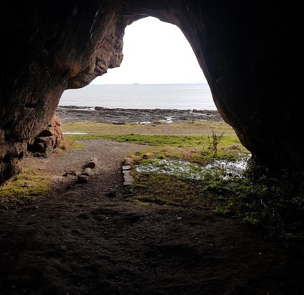
It was the East Wemyss caves that had been bothering me ever since reading that Val McDermid novel; not just to imagine fictional murders, but to see where Picts had carved strange images in bygone centuries, where people had dwelt, sheltered, hidden, picnicked and stored precious things. But first, when I passed through the woods, I came upon Macduff’s Castle – an impressive ruin whose stonework exhibited all the artistry of a carving, it is so tastefully eroded. All around its roofless vaults grew great clumps of Alexanders, a shiny-leafed, celery-like edible plant not native to these parts, but where it takes off, it does so with enthusiasm. I circumnavigated the castle before heading down the cliff to the caves.
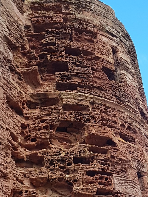
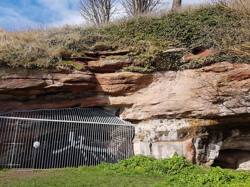
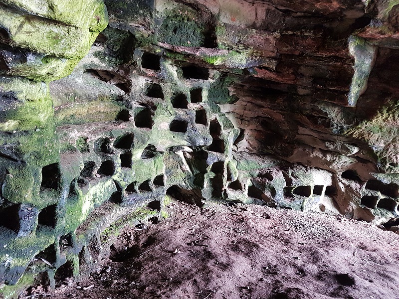
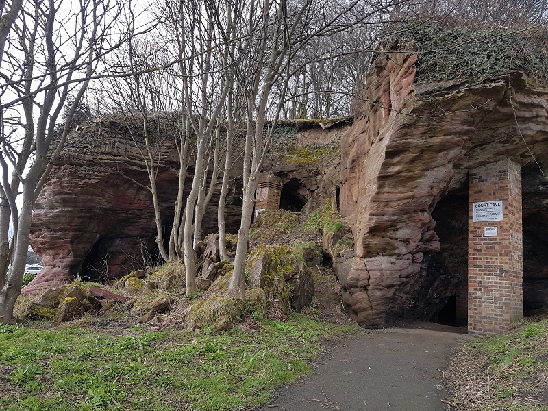
I had been warned that the best bits of the caves were gated off by substantial railings, in order to protect the ancient carvings. You can get a guided tour of them if you go to the museum in East Wemyss, but I didn’t want that today. So I stood outside Jonathan’s Cave and used my imagination instead, then stood inside the Doo Cave, where dozens of little cubicle nest holes have been carved out of the soft red sandstone to accommodate the doos, kept for meat and eggs in years gone by. At the large Court Cave, I did my exploring along with other visitors until my excitement subsided.
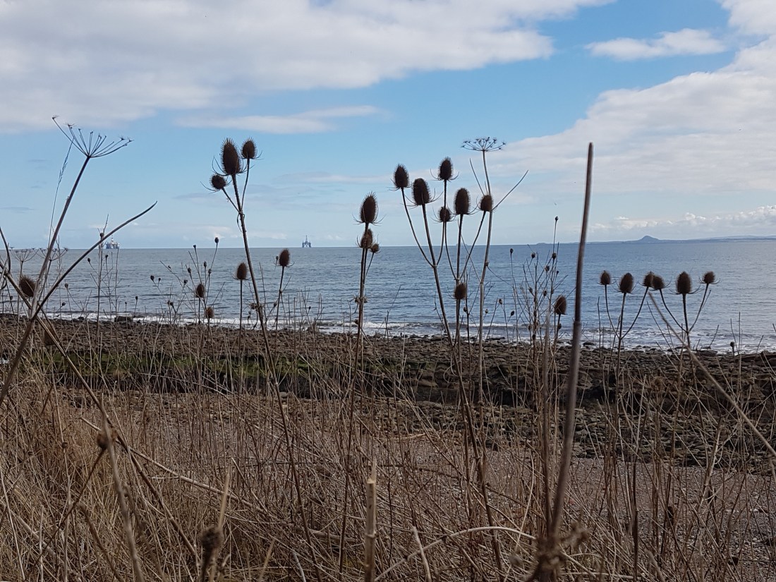
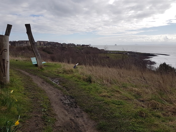
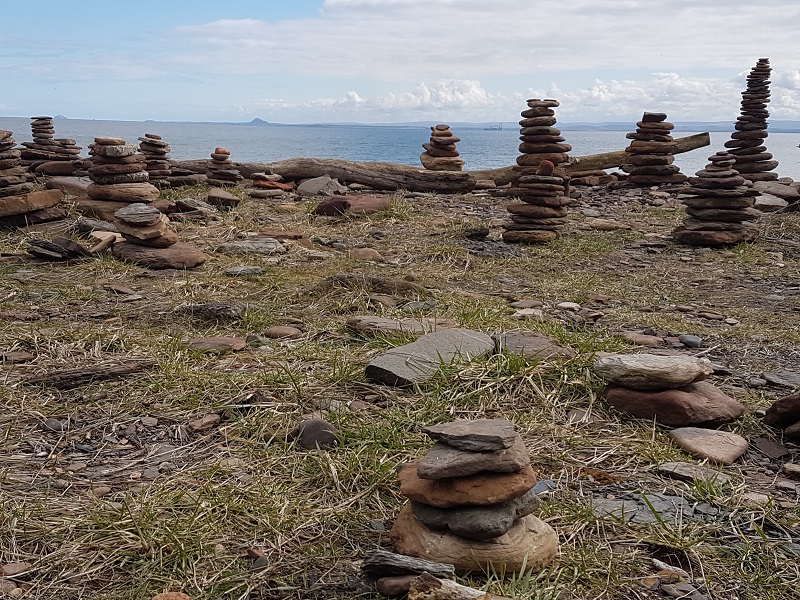
Then I walked on, the sunshine now spring-warm, past a gaggle of East Wemyss monuments and memorials, side-stepping mine ventilation shafts, to re-join the path by the sea. Rafts of eider ducks sailed by, making their weird, cooing, gossipy calls, and cormorants lined up on rocks. Strange but recent sculptures in stone arose against the skyline like sentinels; I added to them, noticing how the stiff uprightness of last year’s teasel seedheads mirrored their form. Under the precipice on which the relatively modern Wemyss Castle teeters, and I was into happy little West Wemyss, basking, and its lovely cafe for tea and a well-earned salad.
Looking forward to the next Fife coast exploration!
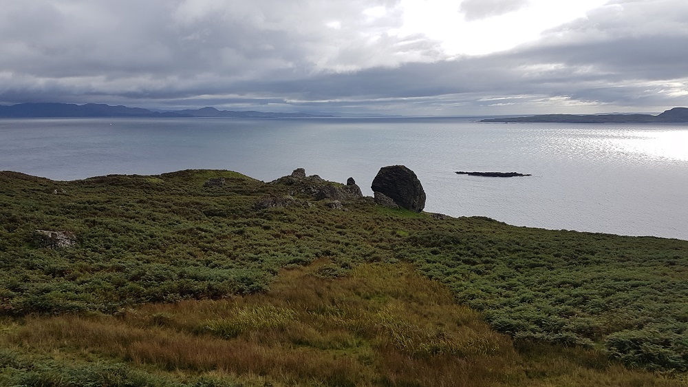
The track we follow is purposeful. It has the directness and air not just of going somewhere, but of having been going there for a long, long, time. We get to it from another determined little track, that rises up from the calm waters of Galmisdale Bay, through woodland to the uplands of a hill farm. Side-stepping the sheep and their copious leavings, ignoring the bull who is also ignoring us as he lounges among his harem, we skirt the farmhouse and its hollyhocks, and turn onto the Grulin track.
Straight, easy, well-founded with centuries of stone and tamped by more recent ATVs seeking sheep, the track passes the remains of a fort on the left; hut circles lurk in the grass and bracken between track and cliff edge – we know they’re there but cannot discern them. To our right looms the monstrous tower of An Sgurr, the dramatic reminder of an outpouring of volcanic pitchstone that dominates the Island of Eigg.
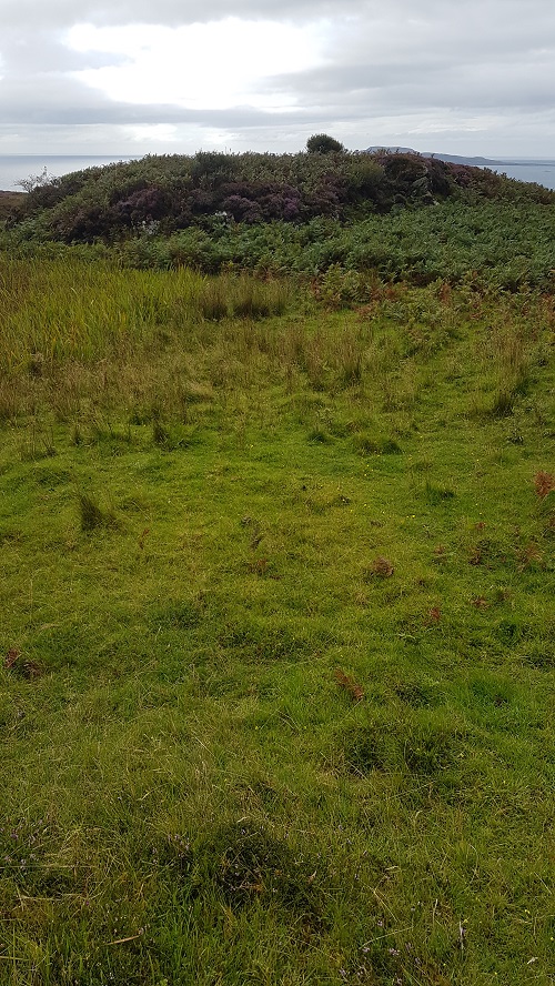
The track becomes a path; there are a few boggy bits, and lots of ups and downs, but it is still clear, still purposeful. So many feet have imbued it with purpose. The first thing we notice that hints we are approaching Grulin Uachdrach or Upper Grulin are some angled, straight lines of raised turf. They are buried dry stone walls, created long ago from the stony, rubble-laden landscape we traverse. They mark irregular fields and enclosures that would outlie and tangle with the settlement itself. Bracken and heather, with snatches of rush and bog cotton form the matrix of vegetation, but suddenly I am arrested by an open, grassy mound to my right.
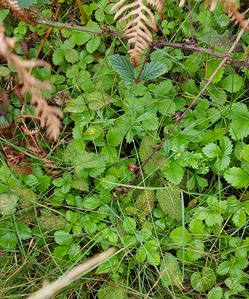
I know from the map we are not quite at Upper Grulin. But I head off for that mound, and feel a prickle in my spine, a sudden silence in my head. On the edge of that sunny clearing, I stop. The wind is stilled. Are there walls beneath me or not? I walk through – or is it over? – the softly waving pale green grass, and step – is it outside? – into the tufts of fern and heath. I think, am I walking someone else’s path, or one created by my imagination? And then there it is – a small patch of stinging nettle, the signature of the midden. Someone lived here once. So I follow their path, and it leads around the cnoc to a south-facing rocky bank covered in wild strawberries. I get it. I, too, would have passed the midden to get fruit for my porridge every summer morning.
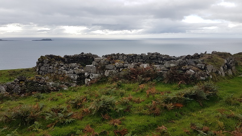
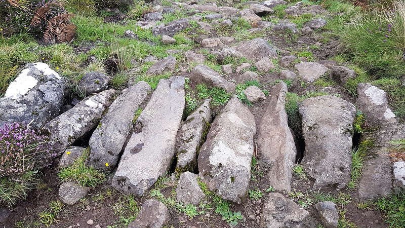
Most of the ruins are more visible, and soon they come into view. Indeed, the first is roofed and is in good repair, with new windows and fresh white paint. It was the one house left for the shepherd when the whole village (which had held 103 people) was forced to leave – “cleared” is the unsavoury term they used for it – by the landowner in 1853 to make way for Cheviot sheep to graze the rich pastures.
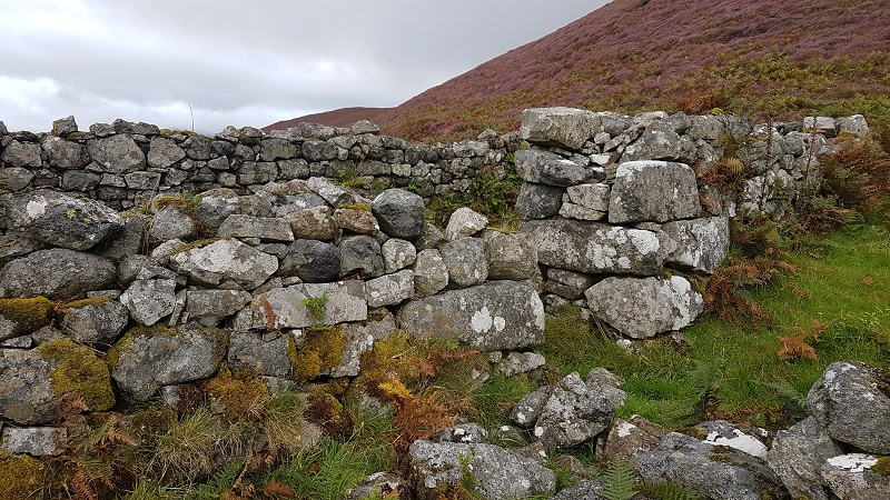
The rest of the buildings are dunts in the bracken, crumbling walls, the hint of a doorway, nothing above lintel height. We continue on the track, now more rocky and difficult, to Grulin Iachdrach (Lower Grulin). Springs gush from the rocks near the path; we cross one by a rough bridge of massive unhewn rocks lain long ago. Later, we founder in a bog – the sort you hop quickly without stopping and your fingers crossed. A kestrel hovers above the ruins, claiming it as territory. Some houses of Lower Grulin are easy to access. All retain their tell-tale nettle patch after 160 years. I stop at a doorway and wonder, can I enter? Eventually I quietly ask permission, and apologise, and go through. Again, the silence, within and without. The questions, the unknown answers; long sea journeys to Nova Scotia; what is left? What is lost? What remains?
The “18 unroofed buildings, 6 enclosures and a field system” drily described in the notes on the 1880 Ordnance Survey map of Eigg to sum up Grulin are not all that’s there. A fort, probably Iron Age, sits perched on a rocky outcrop. Shielings, shelters, kilns and other buildings have been identified. And what remains is that silence – a telling scream of silence. Whatever the end story for the 14 families who were given no choice, that screaming stillness can almost be tasted, bitter and lingering.
But, on this island which has taken control of its fate, this crime can never be committed again.
It was a cold day of freezing fog and dull skies here on the Perthshire fringe of the Highland Boundary Fault, impenetrable and forbidding. So I went to Kirkcaldy with Andrew for the ride, and because if we’re looking for better weather, Fife or Dundee are our go-to destinations.
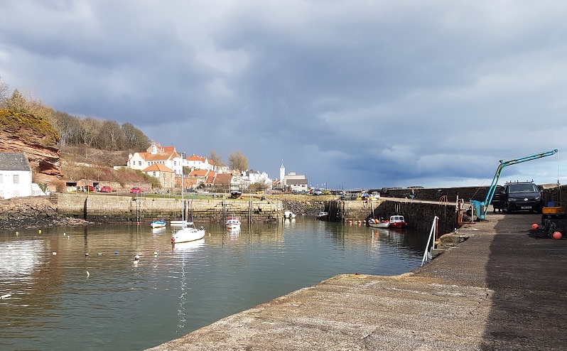
While he was busy pruning trees at Ravenscraig walled garden, I marched down the hill to Dysart harbour, and set off eastwards along the coastal path. Visitors to Fife usually end up either at St. Andrews or the picturesque East Neuk fishing villages, giving the old coal mining settlements of west Fife a wide berth. But I was deeply embroiled in a crime novel by one of my favourite authors, Val McDermid, at the time, and wanted to inspect the haunting locations described, where fictional things had happened and fictional people had so convincingly disappeared, for myself. In so doing, I soon met the ghosts of this once-thriving industry, and the sensed the buried but unforgotten lives of the coal towns and their protagonists.
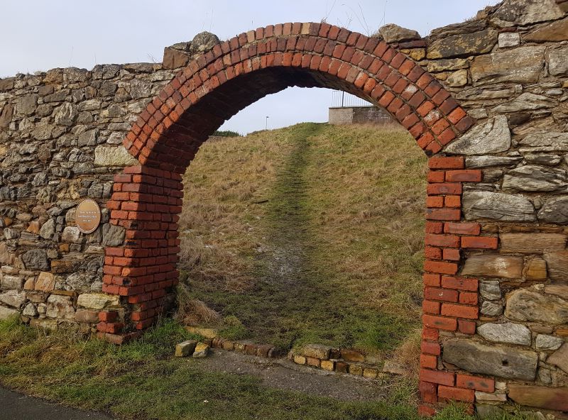
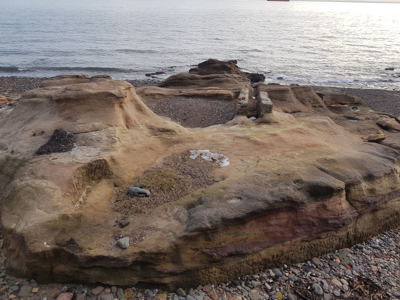
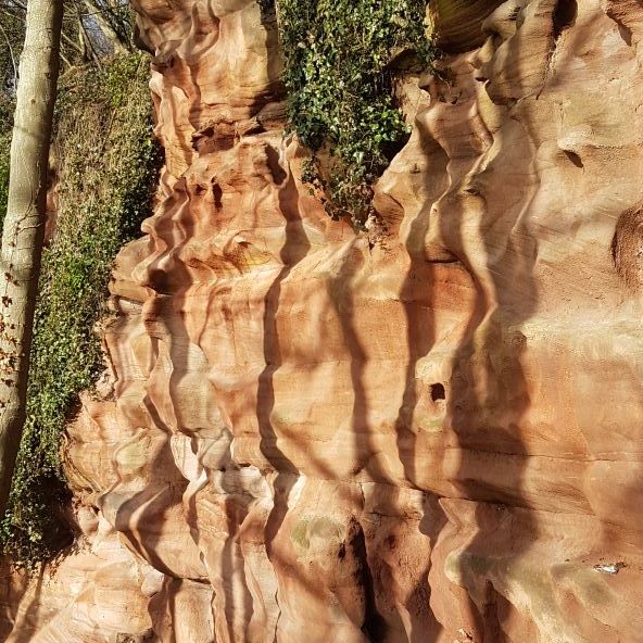
A brick arch in a collapsing stone wall, a desire line path passing through it towards some dilapidated buildings, was all that marked the site of the Lady Blanche Colliery. I walked quickly along the fringe of the beach, where great outcrops of red sandstone, eroded into surreal shapes, looked soft enough to sleep on. Coal seams are found as a layer in a fairly predictable array of sedimentary rocks; where you find this sandstone, you are going to come to layers of shale and mudstone and where they end, you are likely to find the black stuff; ancient plant material from the Carboniferous, compressed by the weight of the rocks and the seas that came to swamp the landscape. Coal. You still find lumps of it, wave-worn, on Fife beaches. Through the middle of one gingery sandstone outcrop a channel had been dug seawards, emphasised by two sturdy walls. Something to do with the mine, or the fishing? I’m no engineer, and couldn’t work that one out.
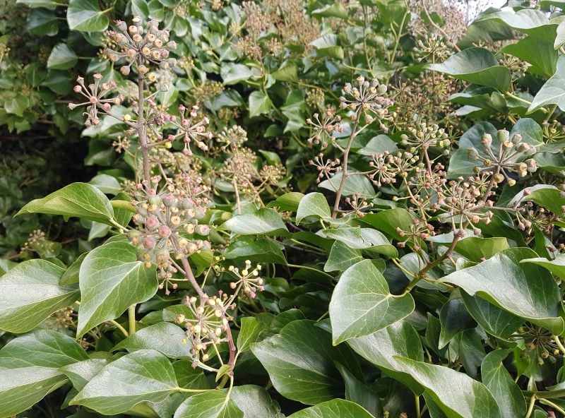
The path veered inland and upwards, skirting a barren-looking stretch of eroding land. I smelt the Winter Heliotrope before I saw the flowers and the foliage that cloaked the steep cliffs. It’s a garden plant, that when it escapes, does so in style and quickly naturalises, especially in difficult sites and thin soils. It is so sweet-smelling you feel for it, flowering away in January when pollinators are scarce, and self-respecting native Scottish wild flowers are keeping their powder dry. But a little further on, I found wild ivy with some flowers on, too, draping itself luxuriantly over sheer cliffs. It usually flowers in November and December – valuable late nectar for bees – and by January bears ripe berries cherished by wild birds. But this was Fife, remember, and Fife does things differently. Already, the temperature was rising and a watery sun floating in and out of tangibility above the Firth.
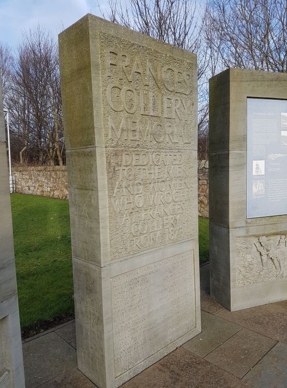
On the very edge of Dysart, I found a striking monument to the miners of the Frances Colliery, bearing the names of all those who had lost their lives there. I found myself muttering the names out loud to myself. What a life it was for miners and their families, the precarity, the solidarity, the tragedy. Something often romanticised, yet here was the bald truth; people died, regularly. Among the names, one jumped out. Agnes Coventry, died 1911. What was a woman doing to get killed at a coal mine? Later, I found out, from the fabulous Durham Mining Museum website, that Agnes had been working at the picking table “when bending under a revolving shaft to reach some dirt which had been lifted off the tables, her clothes were caught by the shaft, and practically torn off. She was removed to the hospital and appeared to be progressing favourably, but she collapsed and died late the same day from shock. The shaft was cased in, but one of the boards which had become loose had been removed and not replaced.” Coal does not just claim its victims underground.
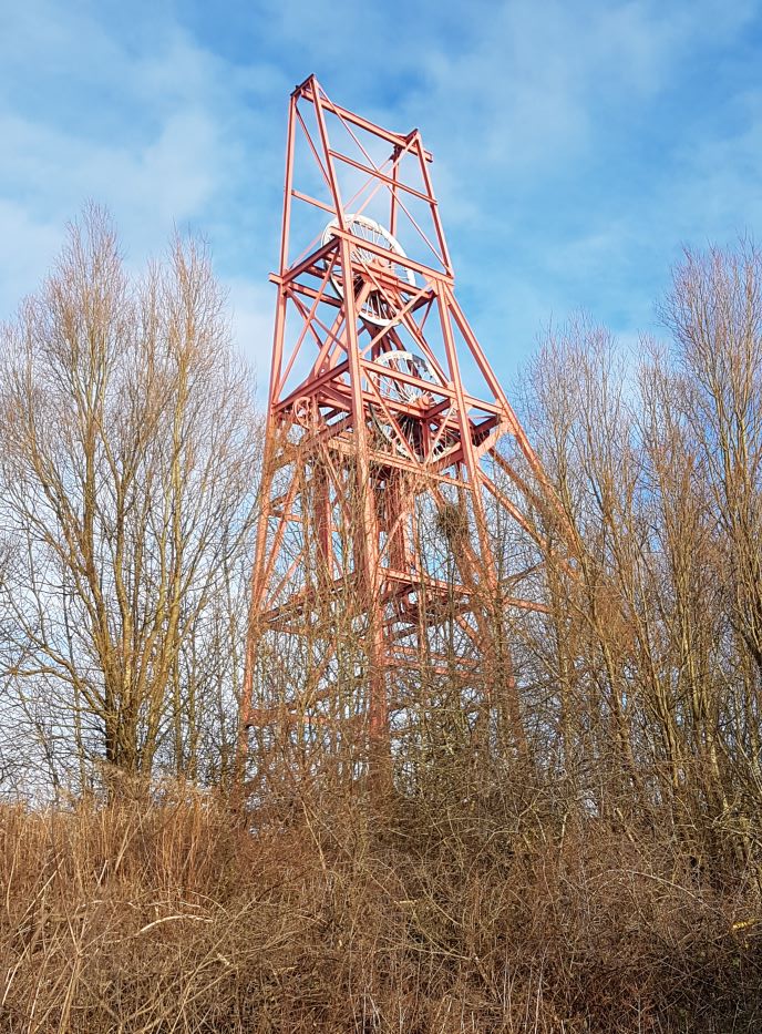
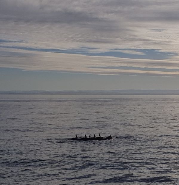
At the top of the cliffs, the path skirted a sinister looking industrial estate, and passed the winding gear of the old colliery, towering over the landscape and lives it once dominated and frowning down on what was now a shimmering sea where strings of cormorants stood drying their wings on half-submerged rocks. The sun, between streaks of cloud, coupled with the uphill climb to tell me I had too many layers on. I took off the thick, fleece-lined woollen jacket under my impenetrably water and windproof coat and stuffed it, protesting, into my rucksack.
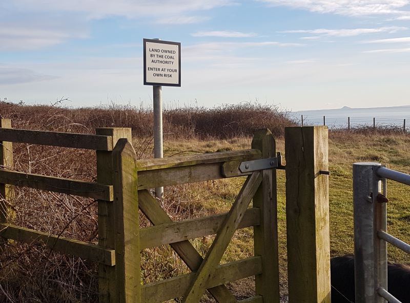
There were great stretches of January-whitened grass and sunken hollows between the path and the cliff edges, badly fenced off, punctuated by warning signs declaring it the property of the Coal Authority. In the distance, several walkers had ignored the proclaimed dangers and were wandering along established desire line paths or admiring the sun-kissed view back towards Dysart. What lay beneath their feet? I ventured through a gate onto the headland for a bit, but soon returned to the path, spooked by signs about sheer drops and risk of landslip.
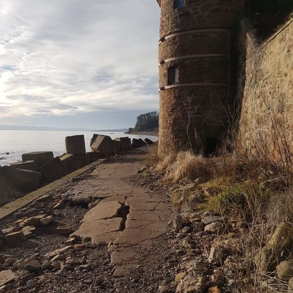
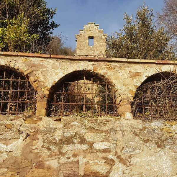
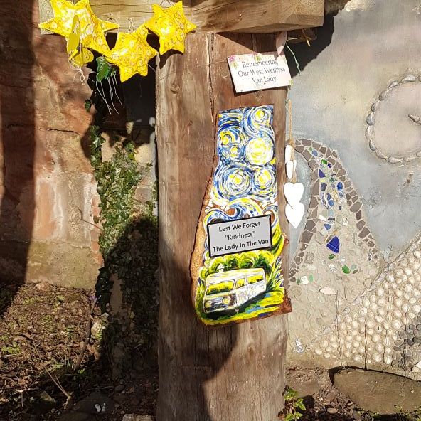
An extraordinarily long and winding set of concrete and stone steps led me back down to sea level and a length of tangled woodland. A solitary raven cronked bad-temperedly overhead at my intrusion into its territory. Before reaching the village of West Wemyss, the path became a rough and potholed concrete track, passing under a turreted wall whose strange arching windows with their keep-out-of-my-land metalwork permitted a peep into the overgrown Wemyss Chapel gardens. Near the harbour was a more homespun and inclusive space. Named as “Alice’s Fairy Garden” on the map, it seemed to be a melding of community projects – artwork and murals, flowers, strange odds and ends aimed at the fairies, and a memorial to “our West Wemyss Van Lady” – whose body was discovered in a campervan in the village car park in 2022. The moulded red sandstone cliffs and overhangs were the backdrop to this little patch, and to me they spoke loudly, with streaks of wind-blown layers and bedding planes, and the contortions wrought by the erosion of this soft, mellow rock.
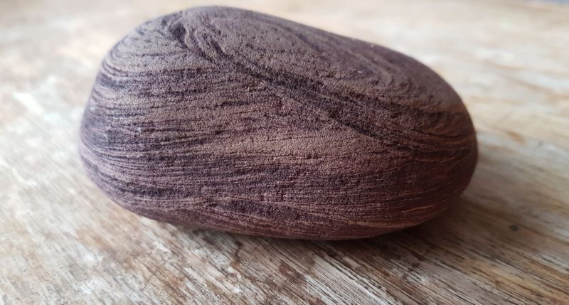
I walked on, hugging the shore to Wemyss Castle, but I was running out of time, and there was a café in West Wemyss that I was glad to return to for delicious soup and a pot of tea, before retracing my steps (yes, even the forbidding stone staircase), past gangs of nosy seals and far more people, now that Fife had fulfilled its promise of sunshine and winter warmth, to Ravenscraig. I stopped on the beach to gather my personal stone from Fife, and found one that encapsulated the properties of the big sandstone outcrops in miniature.
Wemyss Caves, and the stretch from Buckhaven to East Wemyss, will be covered in the next few weeks. It was an eye-opening walk, a thought-provoking one… that centred not only on a landscape but the people who have been, and are, part of it. I don’t know many ex-coal miners, but I do know a few. They are straightforward, confident, cheerful and clever people. They make the very best gardeners and growers.
Early morning, sunny and dry. Silence, save for the mutterings of a river almost out of its banks and racing to reach the sea. Ground solid, unyielding – the type of hardness where you trip up on embedded clods and frazzles of vegetation hiding in the whiteness of a fourth consecutive deep frost – on ground already frozen solid by over a week of snow-half-thaw-freeze again.
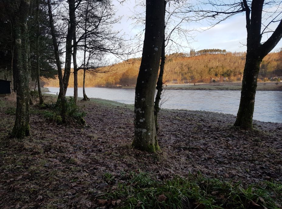
Walking along the south shore of the Tay on a winter’s morning kind of ensures you won’t be in the sun very much, no matter how it dazzles the eye. In any case, the river has merrily engulfed the lower fishermen’s path that hugs its margin, so we walk, me and the dog, on the higher ground beneath the limes of the castle drive. Where are all the birds? I wonder. Not even the ubiquitous wood pigeons are out braving the cold. We pass an eroded river gulley and went down the steepish bank to the lower riverside path, joining at the point where it rises above water level and becomes what must once have been an elegant stroll for visitors to the castle. Fishing on the Tay is big business, and not affordable by ordinary people (unless you live in Perth and have the right to fish the stretch within the city boundary). We pass fishing huts on both banks that would make acceptable homes for small families. All locked up, today. No one but me and the dog.
Now I’m closer to the water, I start to notice a large number of white birds swimming rapidly downriver. What are they escaping from? Then I realise the white birds are actually lumps of ice, breaking away from the frozen banks and joining the ice and snowmelt that, with extended periods of rain, has made the river so massive today. A couple of gritty black-and-white ducks obstinately battle upriver, against the flow. What strong legs they must have! They veer off into a little eddying backwater on the opposite bank, and I see other water birds lurking there, taking a break from morning chores.
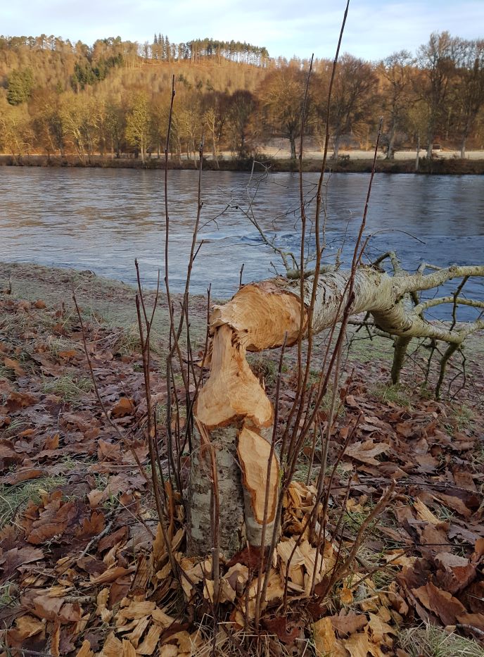
Beaver have been along here recently, but I struggle to fathom their purpose in felling one solitary tree, up the beach from the tumbling water. Maybe just hungry, or doing a bit of coppicing for future regrowth food supplies. I think the water birds could use a few more beavers to create respite backwaters.
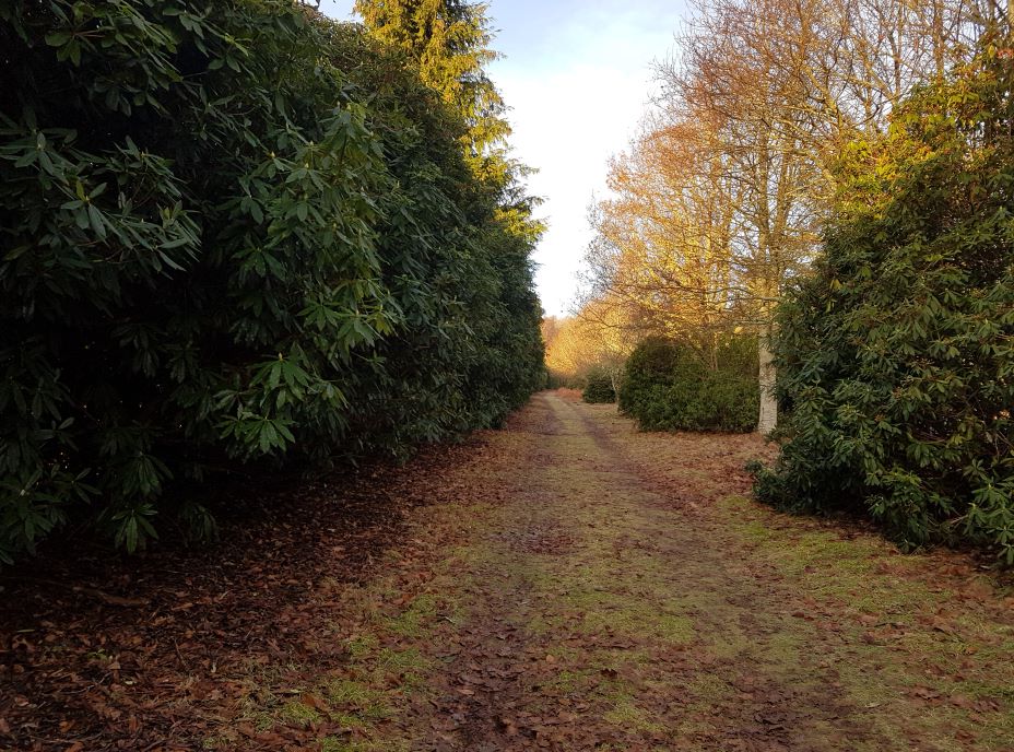
Skirting a long curve round the back of the castle, I pass between forbidding walls of rhododendron bushes. Although they provide some shelter and a small stretch of unfrozen path. they block the view. I spend too much time trying to eliminate them from an ancient oak wood to appreciate their aesthetics. I guess they may provide good roosts for birds, though I still don’t see any.
The core path takes a long, curving route by a bend in the Tay, high above the river and nearly to Birnam before it joins the castle main drive which will take me back to the start if I go left. Closer to the castle, the trees are less scrubby and include many spectacular examples of exotic species, such as Noble Firs, Coast Redwoods and towering Pines. It becomes a landscape of avenues – tottering rows of limb-dropping beeches, stately Sequoias in orderly, sentry-like placings, frowning yew trees in sombre ranks, new avenues planted in recent decades to replace older ones that refuse to lie down and die. Best of all, to me, are the ridiculously shaggy and spreading avenues of old lime trees – each hiding in its own twiggy skirt of epicormic growth. In spring, they provide me with juicy, tender leaves for salad, and intoxicatingly sweet-smelling flowers in summer to dry and make into a sleep-inducing tisane.
As I walk between and under these vibrant specimen trees, I suddenly realise birds have started to chatter, and mixed flocks of finches, secretive tree-creepers and purposeful, hopping blackbirds are awake and accompanying me. Gazing up through the close pine trees, I can just see avian silhouettes flitting busily.
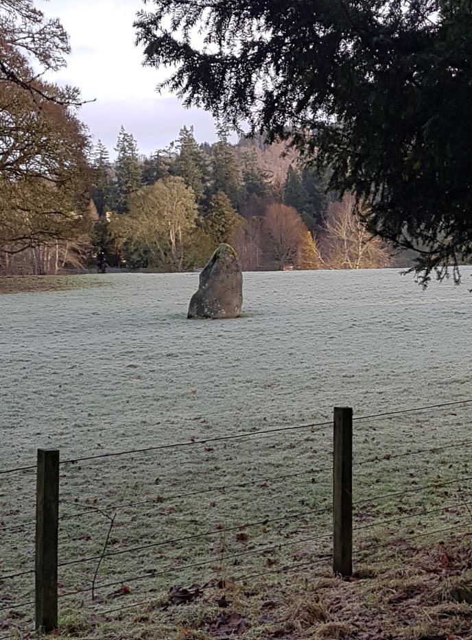
There are paths that could be taken to make a short-cut through the castle garden. Scottish access laws, some would say, give walkers a perfect right to take them, and no doubt some do. I’ve lived in a tied house on an estate where summer visitors frequently asserted this right to take a short cut to a beach through our garden, where we had small children playing and hens free-ranging – and on at least one occasion, hens were killed by loose, uncontrolled dogs. So personally, while I’m proud of our access laws, I think we should respect the privacy of residents and remember those laws also require the walker or cyclist to act responsibly. I’m fine with taking a long way round. The core path eventually passes in front of the castle at a distance (more avenues!), and I note the large, standing stone nearby, like an iceberg itself in an open, frost-enveloped field. It has no name. Does it link with other, less ancient perhaps but curiously-named stones in the area? One day I’ll hunt down the Witches’ Stone (well, this is Macbeth country!) and the Cloven stone….. but not today.
Today, I dawdle back under the limes to the gate, salute the mighty Tay with its miniature ice-packs, and begin to think about breakfast.
So today is Samhain. A Celtic festival to mark the end of summer, and the important transition between two parts of nature’s cycle. Because it is a cycle, it’s hard to know if its an ending or a beginning, both, or neither. But it’s a turning. mentally and physically, seen in the falling leaves and the settling of seed, heard in the song of the robin and the wild geese, smelt in the richness of fungal mould and felt in the night chilling of the air. We move with the season, from one place to another.
It’s also called Hallowe’en, or All Hallows Eve, and marks another transition, between the world of matter and the world of spirit. Some corners of the Earth are known as “thin” places. Some of the Hebridean islands are very thin. You go there, and time slows, the present meets past and future, you see things you’d never notice usually. You react in a different way. Hard to describe, but it’s like another world is almost tangible, separated from this by a filmy veil. Go there. You’ll get it. Well, at Samhain, that veil allegedly gets thinner everywhere, and people see things they didn’t know were there.
I’m not talking about plastic skeletons and vampire costumes and all that crap. The only vampires at Hallowe’en are the retail gluttons out to make a killing out of gullible, competitive parents intimidated by their offspring. Neither am I talking either about the demonisation and demeaning of innocent wise people (women mostly) into caricatures to hang in your window. Jamie Sixt of Scotland (James I of England) has a lot to answer for. And I’m certainly not interested in who has the biggest pumpkin! But yes, I am up for a good ghost story…..
Not, thanks very much, those overblown, ludicrous, gory “horror” stories that just make me laugh or go back to a good book. I like the kind which are incomplete, lack a dénouement, are based on real experience, and for which it’s perfectly possible to find a rational explanation…. And yet…. There was the “haunted house” in Cornwall my family rented when I was 4 years old. All I truly remember was being terrified by strange noises coming from behind the wall, and not being able to sleep. A damp, underheated holiday home is highly likely to house rats, bats or other beasties in its cavities, who moved about at night. The tapping on the bedroom window my sister heard could be explained by an overactive teenaged imagination. The footsteps approaching the back door when no-one was there may have had something to do with my mother’s penchant for telling a good story. And we’ll never know now if, that morning when we came downstairs to find all the furniture moved about, my father had been up in the night playing a never-admitted scary joke on us. And yet….
And there’s our “ghost” here at the cottage we’ve lived in for over 22 years. I used to see it a lot, but it’s been quiet the last couple of years. Avoiding Covid, no doubt. Just a figure, quickly scuttling along past the kitchen window, glimpsed out of the corner of your eye. Never does anything else, never knocks or makes any sound and never inside the house. It isn’t remotely scary. I never mentioned it to anyone for years, and then one day I started as usual as it went by and Andrew, sat in the kitchen with me, said, “Oh, was that her again?” Andrew is the most resistant and sceptical person I know who scoffs at anything remotely “supernatural” (while being secretly scared!), but he “sees” the figure as distinctly female, head covered in a shawl. “Like the Scottish Widows advert”, he says.
Easily explained! any one of a number of “tricks of the light”. I tried to pin it to our reflection in the glass when the kitchen light is on, and yet it appears in broad daylight when there’s no reflection as well. Anyway, we have missed it/her in this period of absence, though we both saw her one afternoon last week. Maybe tonight, when the veil thins, and the world turns……?
If you take the road from Perth to Dundee, you skirt the edges of an explosion of geological delight known as Kinnoull Hill. Sheer cliffs soar up from sea level on your left. In autumn they are swaddled in the glorious golds and browns of beech woodland at the base; in spring and summer studded with the gold of gorse and broom. Dilapidated towers seem to teeter on the edge of the cliffs looking like something Germanic from a Grimm fairy tale (they were put there fore that very purpose).
These dramatic cliffs are the result of volcanic activity some 400 million years ago when a monstrous intrusion of magma elbowed its way through the older rocks in an enormous seam and solidified. Much later, the Kinnoull Hill geological intrusion was part of other monster-scale earth movements – the folding which left us with the Sidlaws on the north side of the Tay and the Ochil hills on the other (it’s called an anticline; think of a rainbow….). Subsequent faultlines and erosion removed the top of a rainbow and created the deep valley through which the Tay now marches triumphantly to the sea.
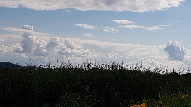
If, however, you approach these cliffs from the other side, the ascent is appreciable, but mild and steady, the slow, back-door rise of the escarpment. I went that way in April, and parked in the Corsie quarry, where volcanic dolerite and basalt is exposed, and from which it was taken for building for centuries. Up a steep bank, and a variety of paths are on offer, taking me first to the trig. point on Corsie Hill and fine views north over the small city of Perth and the vast breadbasket of Strathmore, to the mountains of the Angus glens to the east and the Obneys, marker-hills of the Highland Boundary Fault, slightly west. Up through roads and sheltered by woodland I went on winding tracks. Oak and birch dominate in places, in others, beech and non-native conifers stake a much-contested claim. Areas of heath and rough grassland house woodland sculpture in this popular spot.
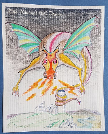
Sometime between all that geology and now, we are told, a dragon arrived on Kinnoull Hill. It glided along the unassailable cliff edges until it found a crevice, leading into a large enough cave for a small dragon to set up shop. This cave, called the Dragon Hole, is high on the cliff and allegedly could hold a dozen adult persons, so it wasn’t luxury accommodation for a dragon. What the dragon got up to, to upset the people of St. Johnstoun (as Perth was then known), I have no idea, but as is the way with relationships between human animals and animals either good to eat or a tad scary, someone was said to have “slain” it. It could have been St. Serf (what IS it with saints and dragons??), commemorated as a dragon slayer in the old church at nearby Dunning.
But my bet is Serf made it up, and the dragon’s still about, somewhere. There is a record that in the late 13th century (first) wars of independence, none other than William Wallace “pressed by the foe, occasionally betook himself to the retreat of the Dragon’s Hole.” In the 16th century, it was the local custom for a procession of youngsters from the town to clamber up to the Dragon Hole on May 1st (the pagan feast-day of Beltane), with garlands of flowers, musical instruments, and what may have been a Green Man. Or was it a dragon, representing the sun god, Bel? Whichever, it certainly cheesed off the local minister. In 1580, the congregation of the Kirk were forbidden to “resort or repair” to the Dragon Hole, on pain of a £20 fine (quite a fortune in those days) and repentance in the presence of the people.
You might think that was the end of it, and the Dragon Hole, together with its occupant, faded and disappeared from local knowledge. I used to teach about landscape character and interpretation, among other things, to Countryside Management students at the local college, and used Kinnoull Hill as a case study. One year, a couple of the lads got quite excited about dragons (can’t think where they got that from), and vowed to find the Dragon Hole. But here’s the thing: their colleague Arlene, a local girl, told us she used to go there as a child and had been let into the secret of its location by an older relative. She also had the good advice that they should not attempt to climb up to it, but abseil down. They went off in cahoots. Term ended before I ever heard if Ryan and Hamish were successful. Knowing them, I wouldn’t be surprised.
That’s Dundee in the distance…
Back to my walk. I came out to the viewpoint on the edge of Kinnoull Hill cliffs, where the ground suddenly ends, and bunches of flowers tell sad stories and remind us of human misery. The views downriver, with Dundee sparkling in the distance, and across to the greens and golds of Fife, with it’s own matching quarries and volcanoes, were more than worth the uphill slog. Everything, especially life, seemed precious to me then. I remembered the tales of the dragon’s hoard of treasure, the enchanted “dragon-stone” which James Keddie found in the Dragon Hole in 1600, the “Kinnoull Diamonds” that are said to sparkle by night. And I came right back to geology. Around volcanic intrusions, mineral-rich deposits hold many semi-precious and maybe precious stones – on Kinnoull Hill, it’s garnets and agates that are best known.
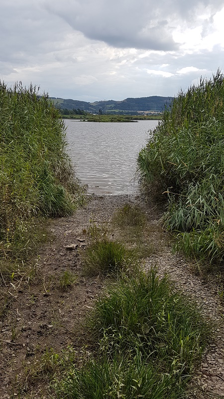
I wanted to walk from Cairnie Pier near St. Madoes west to Inchyra on the Tay estuary. My old map (old being the operative word) said there was a path, but it says that about a lot of stretches of the Tay along the Carse of Gowrie that it would be nice to walk, and it’s often mistaken. Google Maps hinted that if you got really, really close to the ground, there might even be two paths, but it wasn’t committing itself. At Cairnie, the existence of a small car park looked promising, and I found the great river hiding among its own reedbeds as usual, lapping quietly at a little inlet whose stones oozed mud. Fishermen’s paths trailed off in both directions.
Cairnie Pier
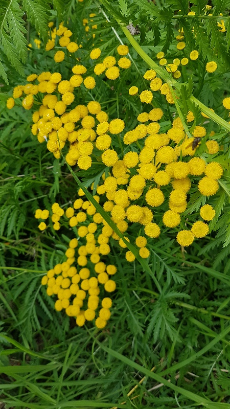
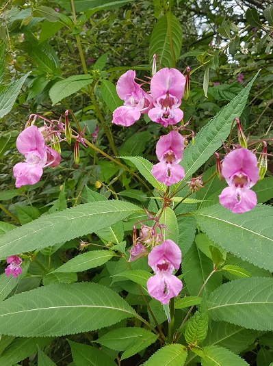
It was drowsy-hot, an afternoon of hoverflies and docile wasps, intent on the many flowers that lined the path. The river is a conduit for all kinds of unexpected vegetation, which thrive in the tidal mud and lovely untidy, unsanitised, hedgebanks and verges. The yellow buttons of Tansy pop up everywhere along the Tay, together with the silvery Mugwort, a long-ago Roman introduction, allegedly a cure for sore feet. Warm and spicy, the scent of Himalayan Balsam over-rode the scents of native flowers, and its spectacular flowers trumpeted a welcome to pollinating insects. This “alien invader” has been around a good while, anywhere near to water, and it’s a Marmite plant. Speak to any beekeeper and she will wax lyrical about the “ghost bees” who return somnolent and satisfied to the hive, covered in its dense white pollen. Speak to most mainstream ecologists and they will say it’s invasive, outcompetes “our” native flora and has no place in “our” countryside. I love its other name – Policemen’s Helmets – does anyone remember when policemen wore helmets? The top and bottom lips of the flower are encased in a helmet-like fusion of the other petals. I’ve happily pulled it out of ancient oak bluebell woodland, but I can’t say it bothers me too much today. I munch a couple of the peppery-pea tasting unripe seedheads, out of duty.
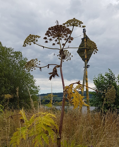
But then arise the forbidding, towering structures of a harder-to-love alien. Giant Hogweed, introduced by gullible and novelty-obsessed Victorians to adorn their fancy gardens. Apart from its spectacular, H.G. Wellsian-Martian structure (still being extolled by lecturers when I learned garden design), it is low on redeeming features. It is truly rampant, flowers and seeds everywhere and delivers serious burns to anyone brushing against it in sunny weather. It’s a property called phytotoxicity, and today the sun was shining and I passed gingerly.
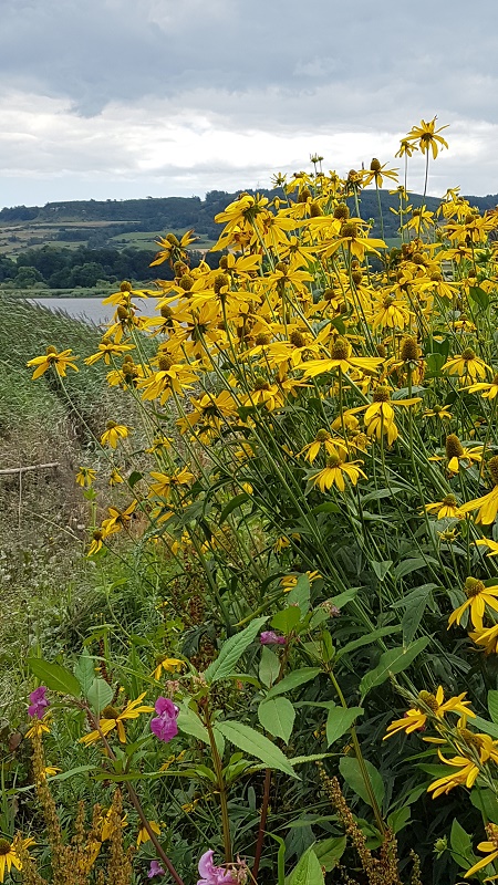
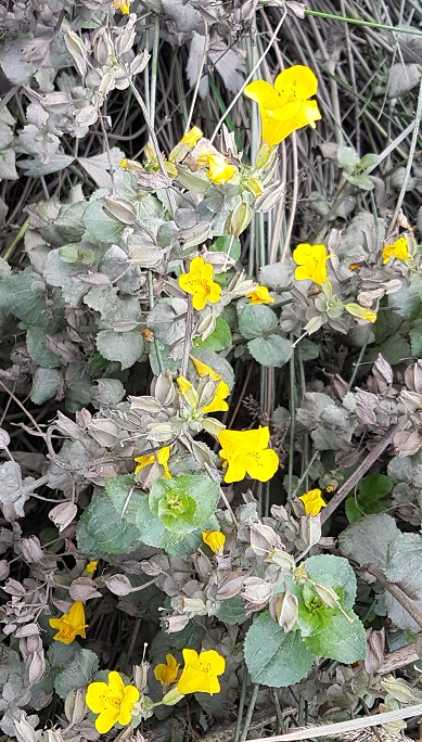
Far more attractive, and indeed glorious were the bright yellow, sunny Monkey Flowers, coated in tidal mud, and the clumps of tall Rudbeckia, both garden escapes, that sway gently in the breeze up the river. They are dotted all along this stretch of the Tay. I remembered another sunny day talking with David Clark of Seggieden – a great botanist and a man who so loved this river – about whether they “should” be there and what exactly was native anyway, since both of us could be labelled aliens ourselves. We agreed that neither of us were fanatical about racial purity in plants or anything else, but weren’t fond of Giant Hogweed, nor the next invasive alien to show its face on my walk, the Japanese Knotweed. This monster would out-compete the miles and miles of Norfolk Reeds themselves…..oh wait, did I say Norfolk Reed?
Yes that’s right, the incredible Tay Reedbeds, home to rare marshland bird species and a complex, life-affirming ecology, are the result themselves of the introduction of a “non-native”.
My fishermen’s path had petered out, and an attempt to reach Inchyra along the edge of a field also met with failure, so I drove back towards St. Madoes and took a side road left. Thus I reached Inchyra, a beautiful little village of low houses, pretty gardens and derelict farm buildings looking, as they always do, as if a quick afternoon’s work would put them back into service. From this hamlet, crouching among tidal lands as if in terror of sea-level rise, I found a wild garden overlooking the estuary and across to Rhynd, and small moored sailing boats bobbing in the rising tide.
Here was a seat, to the memory of a daughter of a local family, and I sat in complete peace among the reeds, with flowers – native, non-native and all the gradations in between – blessing the air with scent and colour. Even the busy tractor across the water hummed to itself. Rain was forecast; I watched silver-lined thunderclouds pile up on themselves, shift and mutate, and then dissolve again into the blue sky. It was so good to be here.
When it seemed the clouds were getting serious, I found a path that ran beside Cairnie Pow, giving me a good circular walk back to the village. The pow is a local name for a drainage channel, often of ancient origin, that was created to free the fertile soils of the Carse of Gowrie from being marshland. They litter the Carse, and give a sense of being neither quite on dry land nor in water. This one tracked parallel to the path I didn’t find earlier from Cairnie Pier, and then swung left at the point I’d almost got to, where a host of overhead power lines had got together for a gathering. They sky darkened, and the air, hot and still full of the damp scents of flowers, smothered the senses. Young trees, planted by the nearby farm, gave welcome shade. A big, old house rose out of the marsh with no obvious gateway or entrance. It looked dark, empty, full of tales and secrets. I wondered, made up stories in my head, began hearing things and holding imaginary conversations with people who did not exist. Perhaps it was as well that heavy, ponderous raindrops deterred me from more exploration that day.
I will pursue enthusiastically all traces of the Roman and her/his associated allies, foot soldiers and settlers across a British landscape, quite regardless of whether there is actually anything to see when I get there. It used to annoy my partner, trudging miles up hills and across dubious bogs and anonymous fields, only to have me announce, triumphantly “It was here!”, gesturing at a field of wheat. He is more intrigued these days, and even suggests Roman tracking expeditions of his own volition.
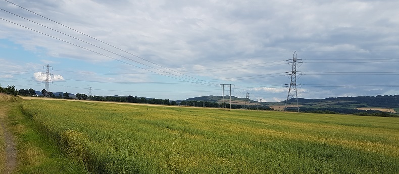
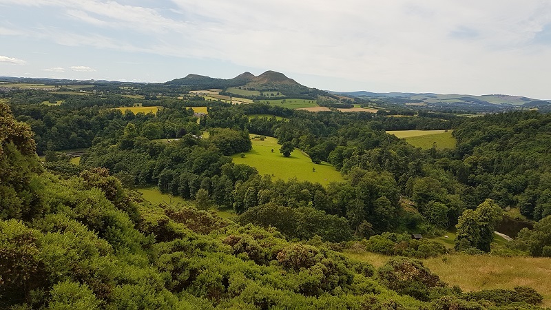
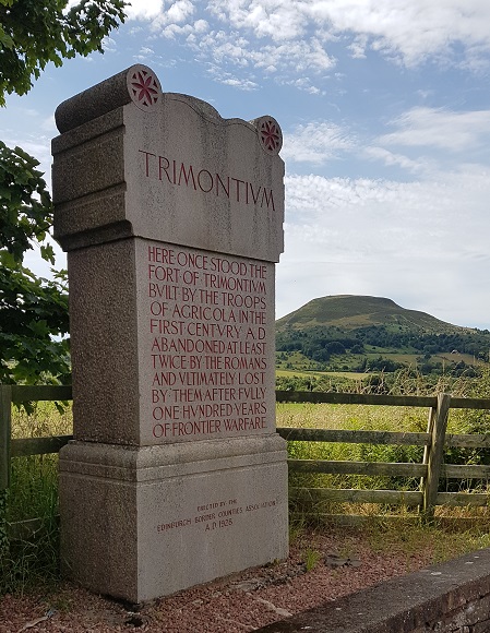
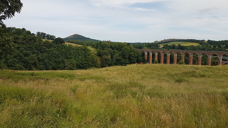
So it was that, once again, we wound up at Trimontium (known more generally as the district around Melrose). The three hills of the name are the Eildons; the Romans didn’t put forts on the tops – someone had already done that – but in this low rolling landscape, the hills must have shouted “home!” to returning soldiers at first sight, and assisted in sighting the meticulous straightness of their military roads. No, the Romans built their camps nearby in the valley of the Tweed, settled, traded, and called it Trimontium.
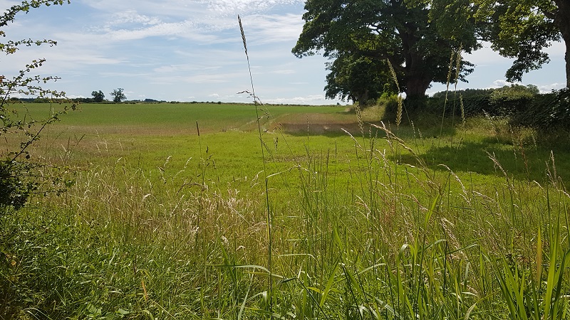
We cycled the length of the old road that cuts through the fringes of the camps, admired the crops in the fields where they allegedly lie buried, passed the site of a Roman circus where nothing could be seen, read the interpretative signs, and felt the whispering ghosts of legions march by. When we reached the site of the Roman bridge over the Tweed, we crossed on the newer one and cycled on to Dryburgh.
A Roman camp (site of!)
A Roman Circus was Here (Honest!)
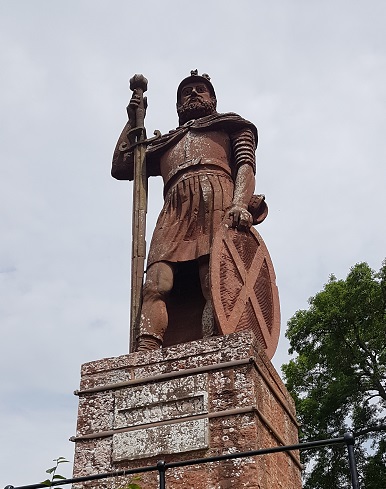
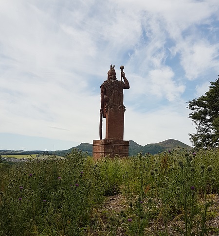
On the way we detoured to see the magnificent statue of William Wallace, a later and better known hero than Gnaeus Julius Agricola. He looks at home, gazing out forever across the valley to Trimontium, the three hills of Roman Scotland, every inch the warrior, rising from a sea of thistles. You could imagine perturbed, defiant, indomitable Caledonian thoughts – the thoughts that once challenged Agricola, and still challenge today. Or don’t imagine; you could think them yourself.
“There, like the wind through woods in riot, Through him the gale of life blew high; The tree of man was never quiet: Then ’twas the Roman, now ’tis I” *
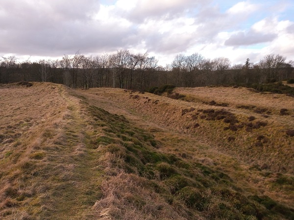
We went on to search for what remained of Dere Street, the road the Romans made from York to end at Trimontium, but which kept on growing to the Antonine Wall in Scotland’s central belt. Tell-tale straight lines jump out of maps; footpaths and tracks link bits of road seperated by farmland or forest. Here and there, we drove along it; the A68 out of St. Boswells was built on top of it. Near Jedburgh, we found a road that crossed it; a long straight footpath bore its way north-west; littered by large stones and rocks – way-markers? – and changes in level we dreamed into being the remains of the vallum, the rampart and ditch that lined important roads, as we marched up it into the dusk and crows took off from dark clumps of trees. In the foothills of the Cheviots, only a few kilometres from the border with England, Dere Street emerged once again, passing close by a set of Roman camps whose earthworks were, in places, still just visible.
Back home, we reminisce over our last visit to Ardoch, the Roman fort near Braco, in spring, and compare how wonderfully well preserved it is, in comparison with Trimontium and these Border camps. Clear are its neat square corners, it’s easy to count and follow the ramparts and ditches, and you can walk into the fort by the original entrances. Luck or design have conspired for Ardoch not be put under the plough too much; no roads have been constructed over it. Trees have grown, that’s all, and even they seem to follow Roman straight lines and military discipline. They tower, wide-spaced, vigorous, energetic.