In the weak, blinking sunshine, wind-chilled and watery, The top fields swarm with detectorists from West Lothian, Thinly spread, rigorously spaced, slowly they move, like cautious extra-terrestrials, each has a rigid, but fluidly-swaying trunk, held just above the ground, all wear rucksacks or cloth bags that sport spade-shaped antennae.
Every so often, a detectorist drops to his knees and starts to dig, carefully refilling each hole before moving on. I greet a smiling pair of them at the gate. “I only get Sunday off, but I wouldn’t be anywhere else,” says one. Do they find treasure? Laughter rings – “be better off buying a lottery ticket for that!” But…. each has a tale to tell, of tobacco tins and Victorian pennies; last weekend, a Bronze Age spearhead – “in this very field!” And anyway, “it’s this I enjoy best,” – throwing an arm towards the hills, the grazing geese, the spruced-up-for-spring yellowhammers in the hedge – “being outside. The scenery. And the people are all lovely.”
They are. I admire their hi-tech gear, wish them luck…. And off they go again. Watching their measured tread, I know (whether they do or not) detecting’s a walking meditation, just as anglers sit and meditate on water, fish or no fish.
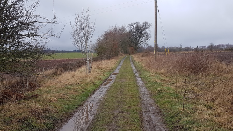
The track we follow is purposeful. It has the directness and air not just of going somewhere, but of having been going there for a long, long, time. We get to it from another determined little track, that rises up from the calm waters of Galmisdale Bay, through woodland to the uplands of a hill farm. Side-stepping the sheep and their copious leavings, ignoring the bull who is also ignoring us as he lounges among his harem, we skirt the farmhouse and its hollyhocks, and turn onto the Grulin track.
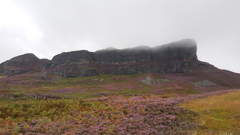
Straight, easy, well-founded with centuries of stone and tamped by more recent ATVs seeking sheep, the track passes the remains of a fort on the left; hut circles lurk in the grass and bracken between track and cliff edge – we know they’re there but cannot discern them. To our right looms the monstrous tower of An Sgurr, the dramatic reminder of an outpouring of volcanic pitchstone that dominates the Island of Eigg.
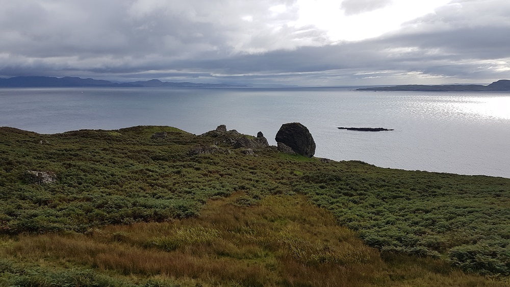
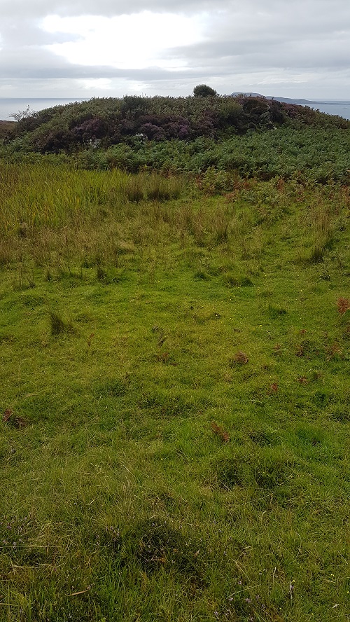
The track becomes a path; there are a few boggy bits, and lots of ups and downs, but it is still clear, still purposeful. So many feet have imbued it with purpose. The first thing we notice that hints we are approaching Grulin Uachdrach or Upper Grulin are some angled, straight lines of raised turf. They are buried dry stone walls, created long ago from the stony, rubble-laden landscape we traverse. They mark irregular fields and enclosures that would outlie and tangle with the settlement itself. Bracken and heather, with snatches of rush and bog cotton form the matrix of vegetation, but suddenly I am arrested by an open, grassy mound to my right.
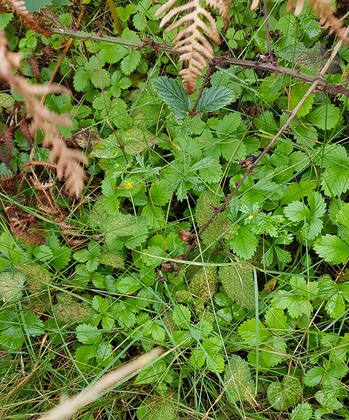
I know from the map we are not quite at Upper Grulin. But I head off for that mound, and feel a prickle in my spine, a sudden silence in my head. On the edge of that sunny clearing, I stop. The wind is stilled. Are there walls beneath me or not? I walk through – or is it over? – the softly waving pale green grass, and step – is it outside? – into the tufts of fern and heath. I think, am I walking someone else’s path, or one created by my imagination? And then there it is – a small patch of stinging nettle, the signature of the midden. Someone lived here once. So I follow their path, and it leads around the cnoc to a south-facing rocky bank covered in wild strawberries. I get it. I, too, would have passed the midden to get fruit for my porridge every summer morning.
Most of the ruins are more visible, and soon they come into view. Indeed, the first is roofed and is in good repair, with new windows and fresh white paint. It was the one house left for the shepherd when the whole village (which had held 103 people) was forced to leave – “cleared” is the unsavoury term they used for it – by the landowner in 1853 to make way for Cheviot sheep to graze the rich pastures.
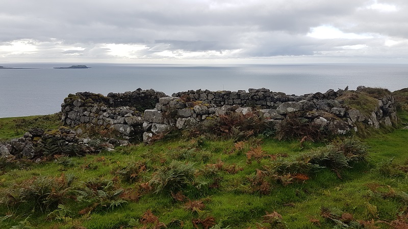
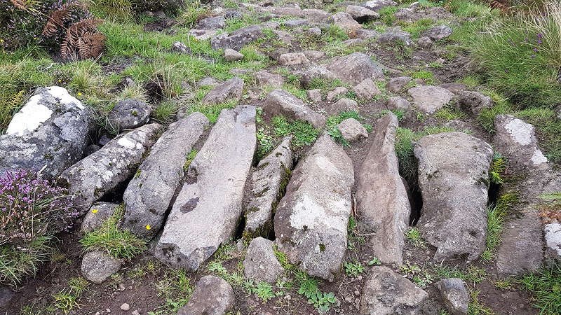
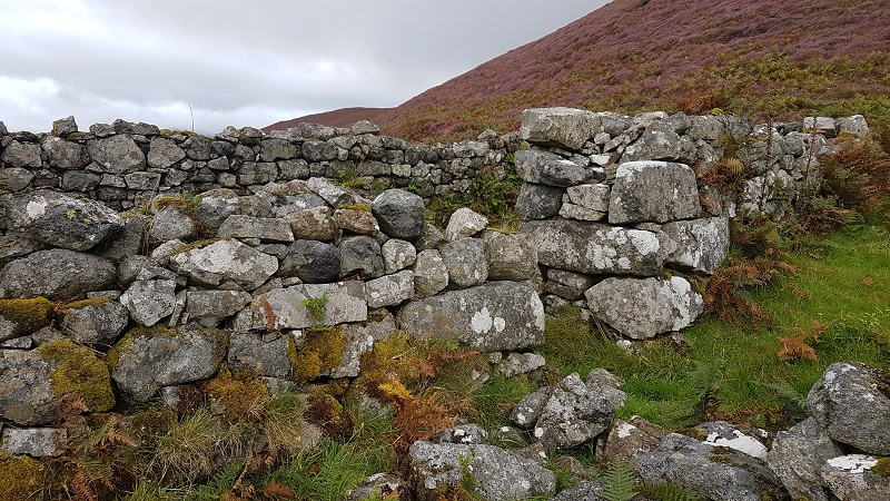
The rest of the buildings are dunts in the bracken, crumbling walls, the hint of a doorway, nothing above lintel height. We continue on the track, now more rocky and difficult, to Grulin Iachdrach (Lower Grulin). Springs gush from the rocks near the path; we cross one by a rough bridge of massive unhewn rocks lain long ago. Later, we founder in a bog – the sort you hop quickly without stopping and your fingers crossed. A kestrel hovers above the ruins, claiming it as territory. Some houses of Lower Grulin are easy to access. All retain their tell-tale nettle patch after 160 years. I stop at a doorway and wonder, can I enter? Eventually I quietly ask permission, and apologise, and go through. Again, the silence, within and without. The questions, the unknown answers; long sea journeys to Nova Scotia; what is left? What is lost? What remains?
The “18 unroofed buildings, 6 enclosures and a field system” drily described in the notes on the 1880 Ordnance Survey map of Eigg to sum up Grulin are not all that’s there. A fort, probably Iron Age, sits perched on a rocky outcrop. Shielings, shelters, kilns and other buildings have been identified. And what remains is that silence – a telling scream of silence. Whatever the end story for the 14 families who were given no choice, that screaming stillness can almost be tasted, bitter and lingering.
But, on this island which has taken control of its fate, this crime can never be committed again.