A Slow Pilgrimage to Siccar Point

Photo by Dominika Roseclay on Pexels.com

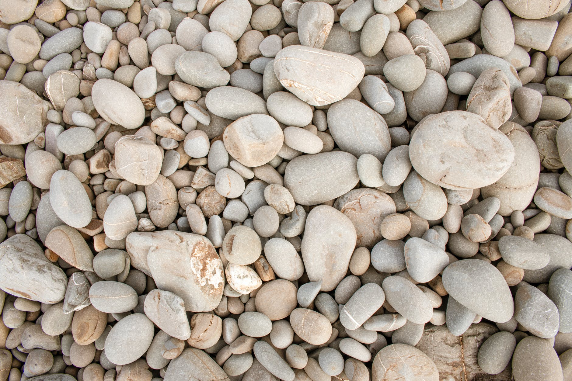
I always liked stones. I collected pebbles on the beach from childhood, and in my teens followed my sister around Ayrshire beaches where the pebbles had magical names – jaspar, carnelian, agate, onyx. I went to the Leadhills in search of galena. I polished stones with carborundum, to little effect.

And, secretly, I developed the habit of having a special stone, of no particular value save that it caught my eye and fitted in my palm, in the pocket of every jacket.

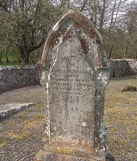
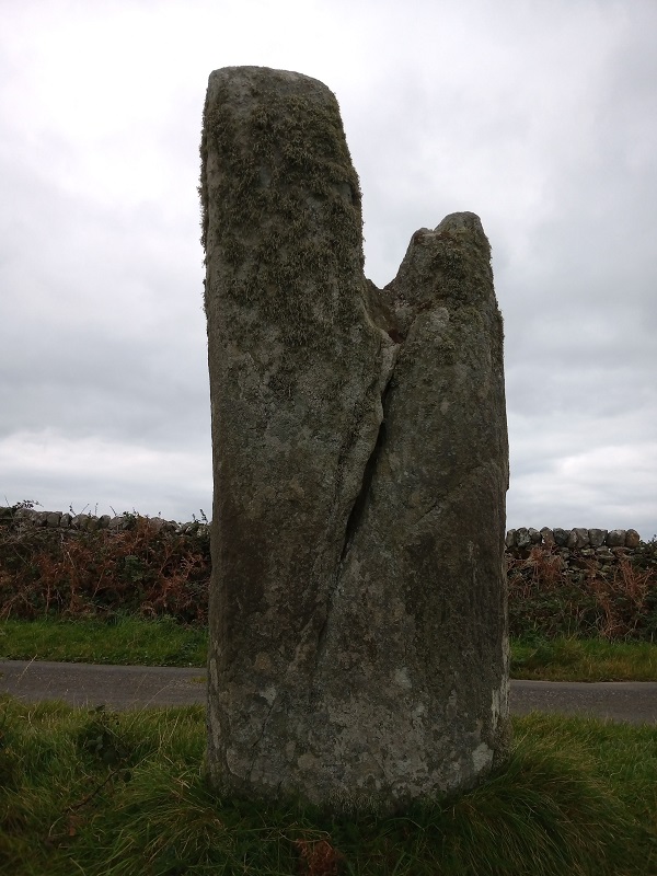
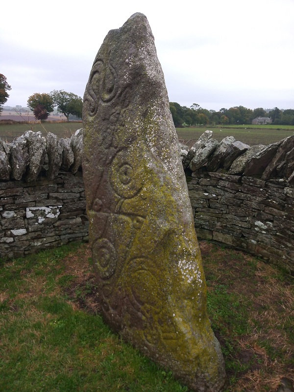
I liked big stones, too, stones with human names and imprints – the menhirs of West Cornwall, the cairns and ring-marked rocks of Mid-Argyll, the carved stones of Pictland. I had no better idea than any expert why they were placed where they were, or what the painstaking sculptures were for. But I knew the people who made stone circles kept pebbles in their pockets, too.

In some kinds of stone, I invested more thought than in others. Granite: shards of feldspar, glittering quartz and the now-you-see-me-now-you-don’t shine of mica. The stone that made up Dartmoor tors, Scottish mountains and an unlikely acid-soiled, heather-clad, craggy-topped park near Leicester. Gritstone: hard-working rock of wind and watermills, a sharp, scraped, glowering edge in the Dark Peak. Quartzite: white, altered stones casting spells on Schiehallion, the fairy hill.

What were these rocks? Where did they begin? How did they get here? Where will they end? Why are they different? Why do they paint different pictures on a landscape? Why did that Leicester park make me feel I was in Scotland?

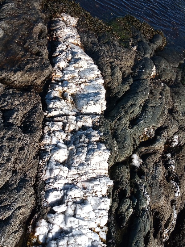
I found out most of the answers by studying Geology and Environment through the Open University, alongside biological sciences. One day on a field trip as I stood with others sketching outcrops, bedding planes and all the various features before me, I suddenly saw it. The landscape which had left crooked teeth of rock strata from one extreme to the other of my field of vision was once a monstrous anticline – one of scarcely imaginable proportions, like an outrageous rainbow. At some point it had collapsed on ancient fault lines. Before these rock strata had formed the bow, pushed up by plutonic forces, they had quietly lain flat and growing, at the bottom of a deep and ancient, long gone sea. I had found a new dimension to reading a landscape – one that underlay all the others.

 As I moved towards completing my degree, two options loomed. Rocks? Or plants? Geologist or gardener? I chose plants, but continued to collect stones, embrace menhirs and mentally compute the past from the present view wherever I could.

And so, one wet, unwelcoming day, we walked the coast path in Berwickshire to Siccar Point, in the footsteps of James Hutton, Hugh Miller and all the great Scottish fathers of geology who had embraced with reluctance or excitement truths about the age of the Earth and the forces behind its formation, all revealed in the inconvenient truth of rocks not being where they were supposed to be.

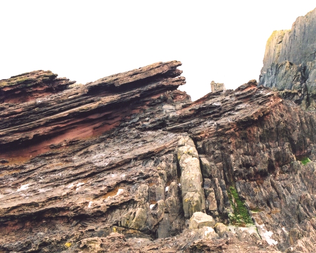
Hutton’s Unconformity.

The wind was fierce and uncompromising. I trembled on the famous cliff, and understood why Hutton had gone by boat. Deposition, uplift, volcanic forces and metamorphic sleight-of-hand. Readable by some, wondered at by many, denied by others. I collected no pebble, no souvenir. Just the imprint of the wind, cold as stone, mutable as stone.

Statutory Exercise into Prehistory

It’s a favourite cycle ride, a circuit of under an hour, with all the hills at the start and you can almost freewheel home, if you go clockwise. A bright, sunny Easter day and a chilly wind; dusty ploughed fields and the great pleasure of almost empty roads, as the pandemic lockdown disrupts the “joys” of motoring.

tullybeltane2

We cycle up through forest research sites and broad swathes of farmland towards Tullybelton, the hamlet whose name may derive from being the field where Beltane (May Day) fires were lit when older and more nebulous gods were remembered. We detour to Little Tullybeltane Farm, where a tall pillar points incongruously at the blue sky, and a buzzard mews and hovers. The track to the farm is neglected and lined with abandoned pieces of rusting metal; there is no plaque, no sign, no clue why it warrants such an imposing monument – and no invitation to explore.

Yet here – allegedly – the ruins of a turnip shed are all that’s left of the birthplace of one Robert Nicoll. From here he walked to school in Bankfoot, stopping to write poetry on the way. He was a peasant lad, a precocious child, the “boy poet” of Auchtergaven who died way too young, the one whose genius may have surpassed that other more famous bard, Robert Burns, with whom he had much in common – had he lived longer. But Nicoll was also a firebrand, a radical advocate for reform, a passionate speaker and fighter in the cause of human rights. Here is his monument, and not enough people know why it’s there.

He was 23 when he died.

tullybeltane3

Leaving Tullybeltane behind, we coast along the Ordie Burn, where wood anemones shimmer in the sun and the wind’s behind us. Bumblebees career in and out of gorse flowers and dive between us. A determined walker out on her statutory exercise waves hello from the proscribed distance as we whizz by. We stop at the old graveyard at Kirkbride – though there is no kirk now and the headstones are in a sorry way. The names are all familiar, local ones: Nicolls and Fenwicks, Petries, Dows, Wylies and McFarlanes. I’m caught by the name Catherine Fenwick on a 19th century stone.

tullybeltane4

A Catherine Fenwick once lived in our house. She inherited or was gifted the feu from James Wylie of Airleywight (another reformer in his day – though did he “sell out” when he became a gentleman landowner?). Later, I check the deeds – we hold the parchment originals – and this Catherine Fenwick died seven years later than ours. Our Catherine lived longer…is it her shadow we constantly see flit by the kitchen window? Strange to think that both of them probably knew Robert Nicoll, whose mother was a Fenwick…. How intertwined we all are.

Kirkbride…. The church of St. Bridget, or just Bridget, or Bride, or Brigid…..Celtic Goddess of water. I can almost feel the Beltane fires. Nearby was St. Bride’s Well, said to have healing properties causing people to drink from it on the first Sunday in May (Beltane flames again) and “walk sunwise round it with joined hands, and lay down branches of rowan”.

tullybeltane5

We find no well, but up on a rise is the standing stone of Pitsundry, said to mark the place. There was within living memory a water trough under a hedge there, supposedly fed by the well. No hedge today, just barbed wire; it’s dry as dust and hard to imagine why there’d be a well on top of the hill. But when I check the maps later, I find a spring marked very close by.

tullybeltane 1

While I’m exploring, another lockdown cyclist tells Andrew (from a social distance of course) that the Pitsundry stone lines up with others on the Muir of Thorn, the other side of the A9. That checks out on the map too, more or less. When we freewheel back into the boundaries of our village, it feels like our journey was further, deeper, more entangled with ghosts, than the quick exercise circuit we set out upon.